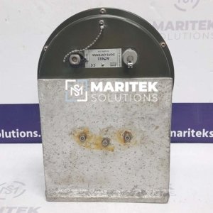
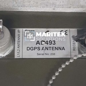
GPS
- Home
- GPS
Ask Question
Do You Need Any
Help?
- Call Us Now:
+91-7226017401
- Talk To Us:
sales@mariteksolutions.com
![GPS GPS](https://mariteksolutions.com/wp-content/uploads/2024/05/GPS.jpg)
GPS
GPS stands for “Global Positioning System,” and it is a satellite-based navigation system that provides location and time information anywhere on or near the Earth’s surface. GPS is a vital tool used in various applications, including navigation, mapping, surveying, scientific research, and more. Here’s how GPS works and some of its key features:
How GPS Works
- Satellite Constellation : GPS consists of a constellation of at least 24 satellites orbiting the Earth. These satellites are spread across several orbital planes and are constantly transmitting signals.
- Receiver on Earth : To use GPS, a receiver device is needed on Earth, such as a GPS receiver in a smartphone or a dedicated GPS device. The receiver is equipped with an antenna to receive signals from the GPS satellites.
- Signal Triangulation : The GPS receiver determines its location by triangulating its position based on signals it receives from multiple GPS satellites. Each GPS satellite broadcasts a signal that includes its precise location and the current time.
- Distance Calculation : The GPS receiver calculates its distance from each satellite by measuring the time it takes for the satellite’s signal to travel from the satellite to the receiver. It does this by comparing the time the signal was transmitted (as indicated by the satellite) with the time it was received.
- Trilateration : Using the distances from multiple satellites, the GPS receiver can determine its exact location through a process called trilateration. Trilateration involves intersecting spheres around each satellite to pinpoint the receiver’s position where the spheres intersect.
- Position Calculation : Once the receiver has calculated its distance from at least four GPS satellites (three for location and one for time synchronization), it can determine its latitude, longitude, altitude, and the current time.
Key Features of GPS
- Global Coverage : GPS provides global coverage, allowing users to determine their precise location anywhere on Earth, as long as they have a clear line of sight to a sufficient number of GPS satellites.
- High Precision : GPS can provide highly accurate position and time information, with modern receivers offering sub-meter or even centimeter-level accuracy in certain applications.
- 24/7 Availability : GPS satellites are operational 24 hours a day, seven days a week, making GPS navigation available at all times, including in adverse weather conditions.
- Multi-Use : GPS is used in a wide range of applications, including personal navigation (e.g., in smartphones and car navigation systems), aviation, maritime navigation, agriculture (precision farming), surveying, geology, and military operations.
- Augmentation Systems : Various augmentation systems, such as WAAS (Wide Area Augmentation System) in the United States, provide enhanced GPS accuracy and integrity for specific applications.
GPS has revolutionized navigation and location-based services, enabling everything from finding directions to accurately mapping remote areas and managing global logistics. It continues to play a critical role in modern technology and daily life.
For sales or commercial inquiries please contact us at sales@mariteksolutions.com
Experiencing problems with any spare parts?
![footerlogo footerlogo](https://mariteksolutions.com/wp-content/uploads/elementor/thumbs/footerlogo-qqnqt1e8n7giupbssfh1h3f5jyqp5oqkru0vpz5c7c.png)
Maritek Solutions is a Stockiest and supplier of all kinds of Marine Automation – Electrical Spares, Navigation parts & Marine-Rig Machinery.
© 2024 COPYRIGHT ALL RIGHTS RESERVED. | DESIGNED BY : 8WEBCOM.COM
Go To Top